Indoor Navigation API for Flutter Developers: Build Accurate Wayfinding Apps Faster
Building a Flutter application that needs to guide people through malls, airports, hospitals or complex indoor spaces? Learn how a navigation API can reduce the work of creating multi-floor, location-aware experiences.
Indoor navigation API for Flutter developers is an increasingly useful search when a mobile application needs more than outdoor GPS. Inside buildings, satellite signals can become unreliable, floors overlap, and customers expect clear guidance to shops, gates, rooms or destinations. Instead of building every positioning component from scratch, Flutter teams can integrate a navigation service into their existing user experience.
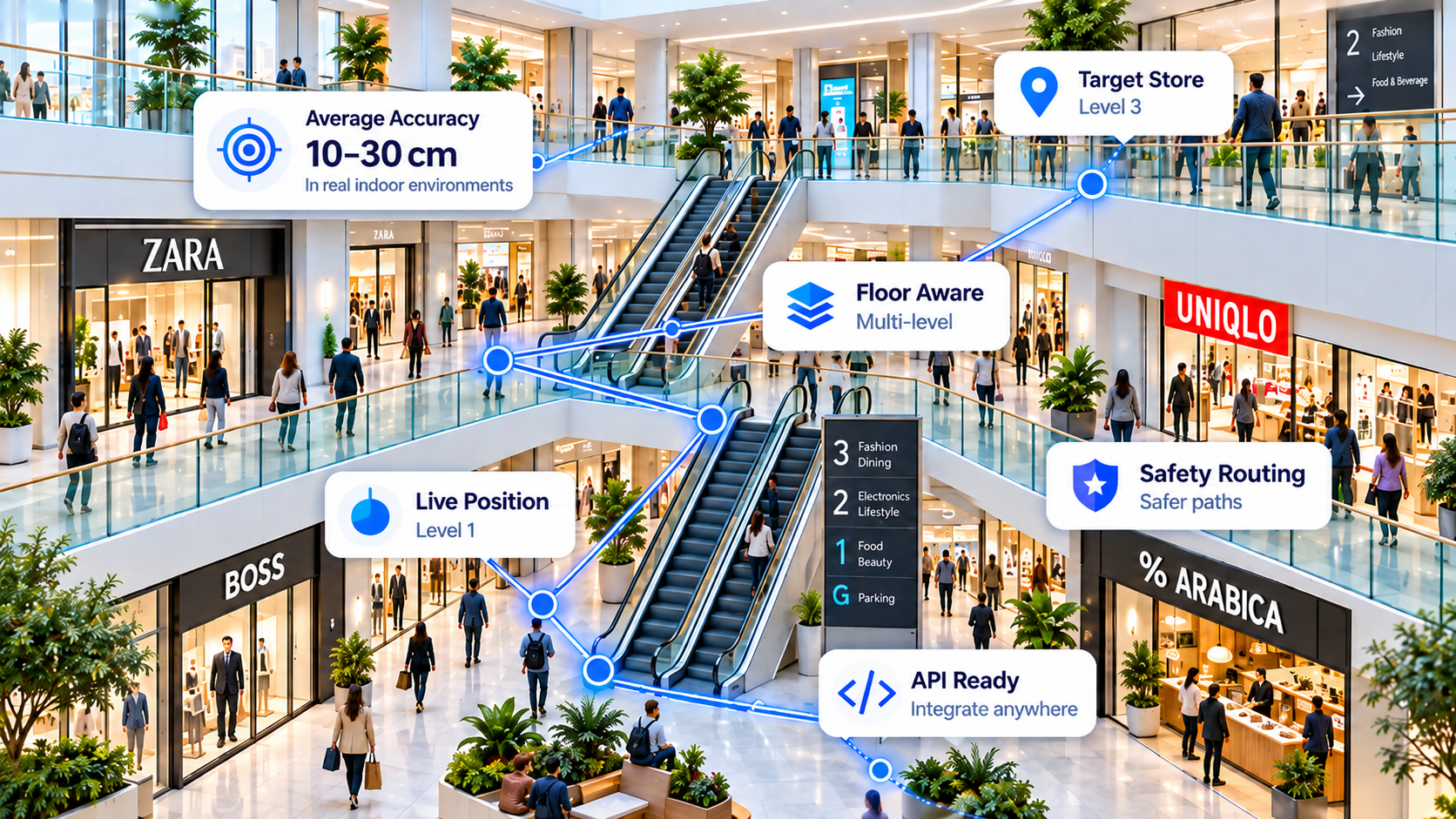
Why Flutter apps need an indoor positioning API
Flutter makes it possible to create Android and iOS interfaces from a shared codebase. But implementing Flutter indoor navigation still requires decisions about location updates, device sensors, routing, floor changes and what happens when a signal is uncertain. Outdoor GPS alone generally cannot provide dependable room-level or shop-level guidance indoors.
An indoor positioning API can help a mobile team separate the navigation intelligence from the user interface. The app handles permissions, displays the route and presents arrival information, while the navigation service provides supported positioning or routing functionality. The exact interface, inputs and response fields depend on the API implementation.
How to integrate an indoor navigation API in Flutter
- Define the user journey. Identify destinations, supported buildings, expected accuracy and whether users must change floors.
- Review the API documentation. Confirm authentication, available endpoints, supported platforms, request payloads and usage limits before writing production code.
- Connect Flutter securely. Use the documented HTTPS integration method and follow the API provider's key-management guidance. Do not embed privileged server credentials in a public mobile binary.
- Handle location confidence. Design clear fallback states for uncertain position estimates, missing phone sensors or gaps in connectivity.
- Test in real buildings. Validate routes, floor transitions, lift and escalator journeys, arrival thresholds and navigation safety on different phones.
IGC Nav positions its service as SaaS navigation infrastructure for developer-built applications. Review the IGC Nav API documentation for the current supported endpoints rather than relying on an assumed Flutter package or SDK.
Sensor fusion, multi-floor routing and beacon-free navigation
Useful concepts for developers to evaluate include sensor fusion navigation, pedestrian dead reckoning (PDR), gyroscope and accelerometer readings, barometer-assisted floor identification, visual references and routing constraints. These approaches can complement one another, but results depend on device hardware, calibration and environmental conditions.
Indoor navigation without Bluetooth beacons can reduce installation and maintenance requirements where software-first positioning is suitable. Teams should still establish what venue data, reference information, phone sensors and validation steps a particular deployment needs. A beacon-free approach does not mean every building is immediately mapped or that every phone delivers the same accuracy.
Top 5 industries and locations for indoor navigation
Developers can explore the following five use cases when planning a location-aware product:
- Shopping malls and retail stores: Help visitors find stores, services, promotions or facilities across multiple levels. A Flutter wayfinding experience can be combined with shopping and loyalty features.
- Airports and transport terminals: Explore wayfinding to gates, check-in, lounges, boarding areas and interconnecting floors where the necessary route data is available.
- Hospitals and healthcare facilities: Guide patients and visitors towards clinics, departments, reception areas and permitted access routes.
- Warehouses and manufacturing facilities: Support authorised staff navigation through aisles, work areas and complex facilities, with appropriate operational and safety controls.
- Hotels, tourism destinations and emergency services: Develop guest, visitor or staff-guidance workflows, while ensuring safety-critical applications receive dedicated testing and oversight.



What should Flutter developers verify before launch?
For an indoor navigation API integration, plan tests around device compatibility, battery usage, permissions, route continuity, floor transitions, accessible alternatives and unexpected hazards. Treat any advertised indoor positioning accuracy as a result that must be verified against your own buildings and test phones, not as a guarantee.
Building a production navigation service also requires a clear division between the Flutter interface, any mobile-side sensor collection and the backend navigation endpoints. Check the current API documentation for actual integration details, supported methods and commercial terms.
Frequently asked questions: IGC Fusion technology, integration and operations
What makes IGC Fusion more than a plug-and-play navigation API?
A basic indoor navigation API may calculate a route between two coordinates. But a usable indoor experience also needs to estimate where the person actually is, which way they are facing, whether they have changed floors and how confident the system is in each estimate. IGC Fusion is designed around that complete positioning-and-guidance problem. It combines multiple phone-based signals with route context, reference points and software-based corrections rather than relying on a single indoor GPS reading.
For Flutter developers, the technical value is a navigation intelligence layer that can support the positioning and wayfinding workflow behind the interface you build. The implementation still requires app integration, venue configuration and real-world validation; it is not a promise of zero-code deployment.
Which advanced algorithms underpin IGC Fusion's indoor positioning approach?
The IGC Fusion architecture brings together complementary techniques, each designed to address a different indoor navigation weakness:
- IMU sensor fusion: accelerometer, gyroscope and other supported device signals help estimate movement and orientation between dependable location references. Filtering and sensor-fusion methods can reduce noise, while drift still needs active correction.
- Pedestrian dead reckoning (PDR): step and motion estimates help track progression when satellite positioning weakens. Since small errors accumulate, PDR works best when periodically corrected with trustworthy reference observations.
- Barometric floor-change detection: supported phones can use relative air-pressure changes alongside motion patterns to help identify vertical travel, such as lifts, stairs or escalators. Devices without a barometer require a different fallback strategy.
- Computer vision and OCR anchors: visible signs, shop names and recognised environmental features can act as location references where permissions, image quality and venue conditions allow. Feature matching, including ORB-style visual features, can help distinguish similar-looking areas.
- Map and route constraints: corridors, floor transitions and approved walkable routes help reject physically implausible movement estimates, such as crossing walls or jumping between unconnected floors.
- Confidence-aware correction: rather than treating every sensor observation as equally reliable, a fusion pipeline can weight available signals, detect inconsistencies and update position as stronger evidence arrives.
These are architectural techniques, not a guarantee that every device or venue will deliver the same precision. The production endpoint documentation and deployment tests determine which inputs, outputs and features are available in a given integration.
How does IGC Fusion improve accuracy compared with GPS-only or single-sensor solutions?
GPS-only indoor navigation is vulnerable to signal obstruction and reflections, while compass headings can be disrupted by metal and electrical installations. PDR alone drifts over time, and visual recognition alone may fail in low light or changing environments. Multi-sensor fusion aims to reduce those individual weaknesses by allowing one useful observation to correct another: motion estimates bridge gaps, recognisable landmarks can reset accumulated drift, and floor-transition evidence can narrow the possible location.
IGC Nav has an ambitious indoor precision objective, but figures such as 10–30 cm should be treated as development targets or context-specific test results, not independently verified universal production performance. Developers should request measurements such as median error, 90th/95th percentile error, convergence time, floor-identification accuracy and drift over repeated routes on their own phones and sites.
Why integrate IGC Fusion instead of building indoor navigation from scratch?
Building a Flutter screen with a map and a moving arrow is only the visible portion of the work. A custom engine also requires sensor synchronisation, coordinate transforms, calibration, motion classification, floor detection, visual anchors, route constraints, uncertainty handling, device testing and backend observability. These components must keep working together as phone hardware and building conditions change.
Using IGC Navigation APIs offers a way to reuse a specialised navigation architecture while your team concentrates on the app's experience, authentication, destinations and customer workflows. Whether this is a better choice depends on current endpoint coverage, deployment requirements, pricing and the amount of customisation you need. A mature in-house positioning team may make a different trade-off.
How much implementation time could an existing navigation API save?
There is no honest universal claim that integration takes a fixed number of days. With a compatible API, an initial Flutter integration proof of concept may avoid months of exploratory algorithm development, but production readiness depends on venue data, supported devices, indoor testing, UX, security and your team's existing codebase.
Compare the two workstreams realistically: an in-house build must design, implement, tune and maintain the positioning engine as well as ship the app; an API-led build can focus earlier on connecting documented endpoints, displaying navigation, validating accuracy and handling edge cases. A short pilot in one building is the best way to estimate your own timeline.
What can teams monitor and view in a navigation dashboard?
For a serious deployment, navigation monitoring and dashboards matter as much as the route displayed to users. A well-instrumented fusion solution can make it possible to review API traffic and errors, response latency, sensor availability, positioning confidence, route completion, floor-change detection, drift and field-test performance. These views help developers understand why a route or location estimate succeeded or failed rather than debugging a moving arrow blindly.
IGC Nav's platform includes an administration and developer-oriented direction, with integration and reporting capabilities dependent on the current deployment. Confirm exactly which dashboards, logs, metrics and export functions are live in your account and which require additional configuration or development; this article does not imply that every diagnostic view listed above is already available as a standard product feature.
How are multi-floor positioning, lift travel and safety handled?
Multi-floor navigation requires more than displaying a different map level. A navigation engine should distinguish horizontal walking from vertical movement, select valid stairs, lifts or escalators, and avoid routing through walls, closed areas or dangerous shortcuts. Fusion-based floor inference, explicit floor connections and route constraints can work together to make instructions more coherent.
Deployments should separately test floor transitions, accessible routes, missing barometer data and hazards such as glass barriers, balconies, vehicle traffic and restricted areas. Safety-critical guidance requires dedicated verification and must not rely solely on an unvalidated phone-location estimate.
Does IGC Fusion require Bluetooth beacons or installed positioning hardware?
IGC Fusion is designed to support beacon-free indoor positioning using compatible mobile sensors and digital reference information, reducing reliance on new Bluetooth beacon infrastructure. This does not mean that every building works without setup: routes, reference points, visual anchors, coverage testing and a venue-specific configuration may still be needed.
Is IGC Nav an indoor navigation SDK for Flutter or a navigation API?
An API exposes functionality over documented interfaces; an SDK packages libraries and development tooling. Flutter teams can call compatible APIs without installing a dedicated Flutter SDK. Use the current IGC Nav API documentation to check actual endpoint availability, authentication and payloads rather than assuming a particular package or response schema.
How do I evaluate IGC Fusion before integrating it into a production Flutter app?
Start by creating a developer account and reviewing the API documentation. For a technical pilot, choose a representative building with more than one floor and test several phones. Measure route accuracy, heading stability, floor detection, recovery after sensor drift, API latency and exceptions. Confirm the monitoring views and support model you will have in production before committing to rollout.
Explore IGC Nav for Developers →
Navigation performance varies by device, venue, calibration and deployment. Illustrative industry use cases do not imply an existing customer deployment in every sector.